Today’s focus is on mini-trips (AKA hikes). I LOVE hiking and I’m so glad it’s finally
warm enough in Salt Lake City for us to go into the mountains and explore. Zach
and I started our hiking season off with the most intense trip ever through the
Subway at Zion National Park. Keeping with this theme of starting off super
difficult, we decided to hike Mt. Olympus as one of our first hikes in the Salt
Lake area. The day after Mt. Olympus we did an easier hike with some co-workers
to Donut Falls and some Mines in Big Cottonwood Canyon. Then this past weekend
we tried to make it to Thaynes Peak via the Thaynes Canyon trail in Millcreek
Canyon.
Mount Olympus
Total Distance: 7.75 miles | Altitude Gained: 4100 ft |
Time: 4 hrs 30 min | My Rating: 4.5/5
Notes: This hike is SO HARD! It’s incredibly steep and when
you’re going up you keep thinking, “I must be to the top now, there’s no way
this could keep going,” but it does keep going until you’ve given up on life,
and then the trail opens up and you’re at the saddle. At this point you can
actually see the top of the mountain, but there’s a 0.5 mile scramble to the
top which is much harder than the hike up to that point because you have to use
your entire body to hoist yourself over the boulders to get to the top. But
once you’re at the top you’re rewarded with an amazing view, a nice cool
breeze, and an enormous sense of accomplishment. The only reason I didn’t give
this hike 5 stars was because this trail attracts rattlesnakes (which keeps me
on edge while hiking) and it’s very exposed for a large portion of the trail
(so you have to start early in the day).

Zach eating lunch at the top.


Donut Falls &
Cardiff Fork to Mines
Total Distance: 7 miles | Altitude: 1350 ft | Time: 4 hrs |
My Rating: 3/5
Notes: In general I think both of these trails are super
lame. They’re both easy and flat, so they attract way too many people
(especially families with loud, annoying children) and there’s no awesome view
at the end. We went early in the season and couldn’t see much of donut falls,
so maybe it looks cooler after all of the snow has melted and you can hike up
to it. The trail to the mine was mainly covered is
snow, so it took us forever to get there and I was wearing sandals so walking
through snow and crossing ice cold streams was quite unpleasant.

This is the closest I could get to donut falls.

There was so much snow on the way to the mine.
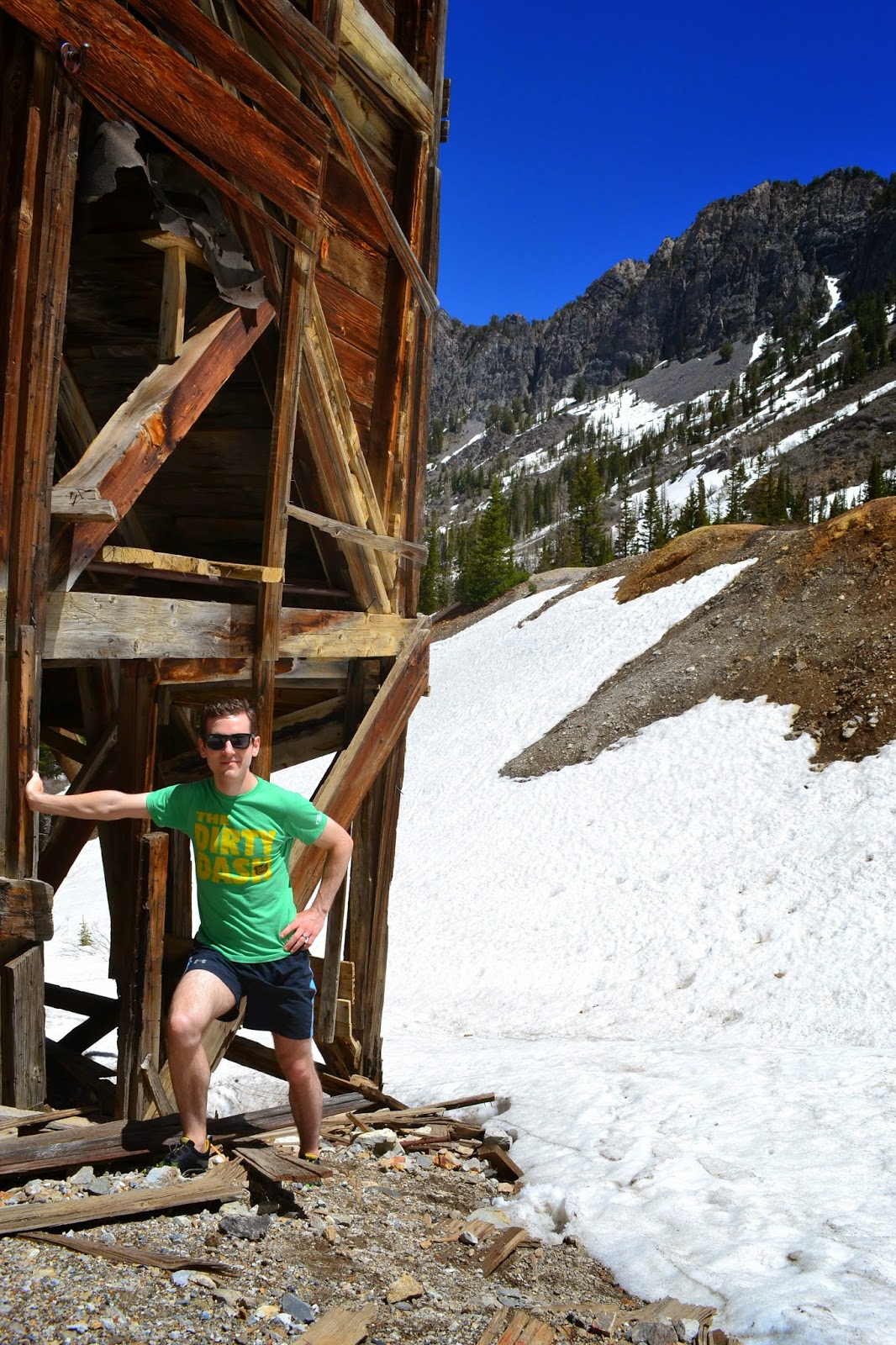
Finally made it to the mine!

Thaynes Canyon Trail
to ???
Total Distance: 6 miles | Altitude: 2500 ft | Time: 2 hr 45
min | My Rating: 2/5
Notes: I hated this trail so I’m not going to write much
about it. Zach and I were trying to make it to Thaynes Peak, but after the
trail split from Desolation trail about 3 miles in, the Thaynes trail disappeared
and we couldn’t figure out where to go from there so we headed back down. The
trail was terribly eroded causing Zach and I both to slip and fall about 5
times each while walking down. For how steep the trail was and how difficult it
was to travel on, I was hoping for a nice view at the end, but we didn’t even
get that, boo.

We encountered the prettiest part of the hike just 0.5 miles in.

The loose rocks on the trail made going down terrible.

I was not enjoying the trip down...
No comments:
Post a Comment